
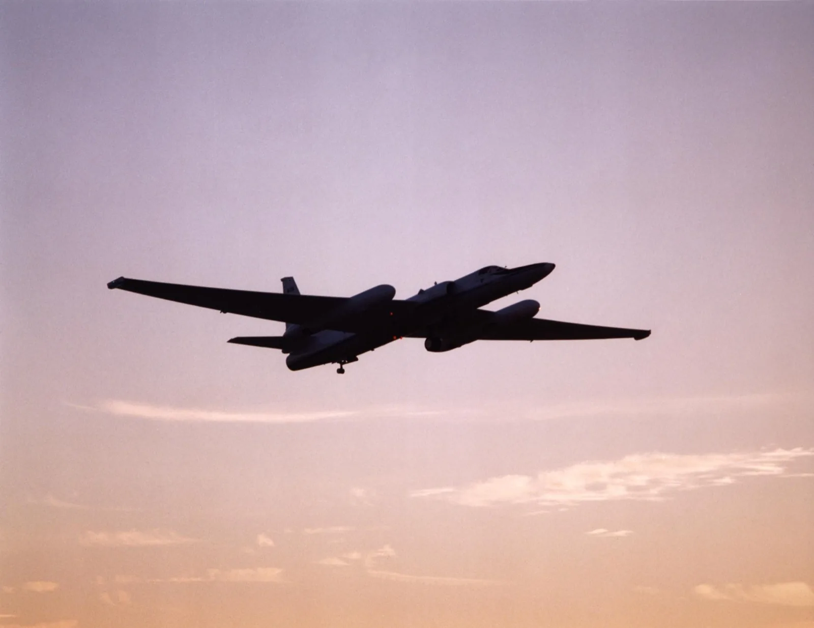
On the afternoon of August 20th I was doing what I do instead of doomscrolling: flipping through random flights near me, seeing who was up there. Regional jets. A Cessna making lazy circles. And then a callsign that made me sit up straight: NASA806, at 60,000 feet, drawing long lines over Washington between the Seattle side and the middle of the state.
Airliners live in the mid-30s. Sixty thousand feet is nearly twice that, a place where almost nothing flies, and the list of things that do is short enough to make a person grin. Of course it was a U-2. And of course I had to ride along.
So I took the window seat. Up there the world barely seems to move: the horizon is hundreds of miles away, the ground turns into a map of itself, and the blue overhead starts giving up and going dark. After a while I noticed something better than the view. NASA806 was flying long, patient patterns, and holding them above another aircraft far below: a Gulfstream V, registration N677F, owner listed as the National Science Foundation. A U-2 pacing a business jet, stacked twenty-some thousand feet apart over the same stretch of the Cascades.
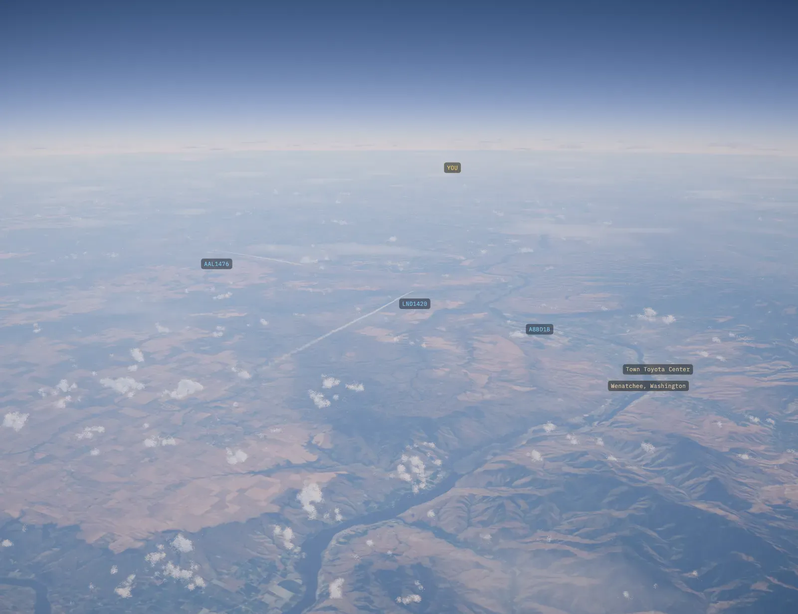
My window seat aboard NASA806 that afternoon, as Stowaway drew it: the Columbia River and Wenatchee off the nose. That contrail below is a commercial flight at something like 30 to 40,000 feet. Look how small it is from here. And look at the horizon: from this seat, it curves.
Better than a screenshot: take the seat yourself. This is that afternoon, twenty minutes of it, holding 60,000 feet over central Washington. It is a replay of the real track NASA806 flew, not a video. Press play and look around.
NASA806 at 60,000 feet
Twenty minutes aboard NASA's ER-2 over central Washington, holding 60,000 feet with the Columbia River off the nose.
The positions are measured, recorded by volunteer ground receivers and published openly. The sun and stars are where they were that afternoon. The clouds are the app’s own, because nobody recorded the sky over Washington that day.
And here is the same view with no rendering involved, shot by an ER-2 pilot out of the actual canopy:
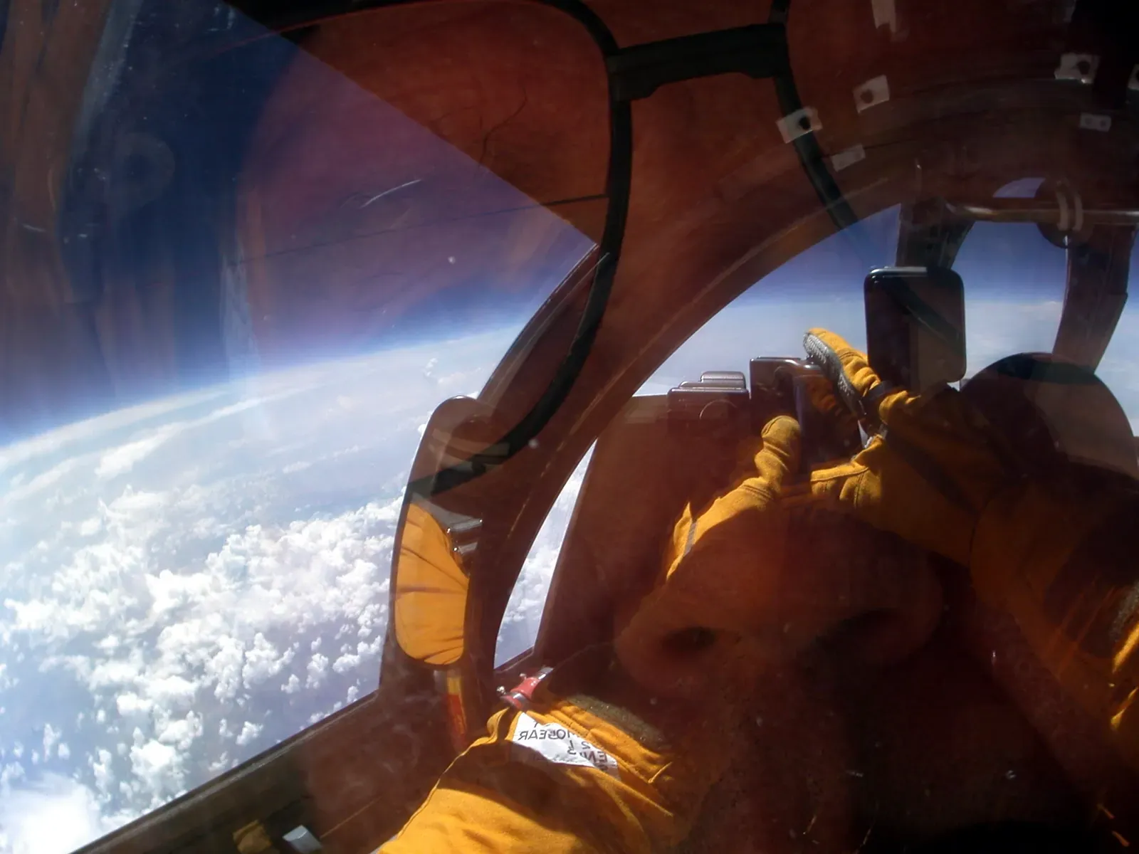
The real thing, photographed from an ER-2 cockpit by pilot Jim Barrilleaux during the CRYSTAL-FACE mission. The horizon curves, and the sky is running out of blue. Photo: NASA / Jim Barrilleaux.
I posted it to Reddit, and someone replied: “I did research on this project in college. They are calibrating weather satellites.”
That turns out to be almost right, and the rest of the story is better.
The plane: NASA’s U-2 that isn’t a spy
NASA806 is an ER-2, the ER for Earth Resources, one of two civilian U-2s flown by NASA’s Airborne Science Program out of Armstrong Flight Research Center in Palmdale, California. It is the same airframe as the spy plane, with science filling the bays where the reconnaissance kit would be. NASA’s pair (N806NA, delivered in 1981, and N809NA, in 1989) can cruise at 70,000 feet, above ninety-five percent of the atmosphere, carrying up to 2,900 pounds of instruments on sorties up to eight hours long, with a range of five thousand nautical miles. So the 60,000 feet I caught it at wasn’t even the airplane trying hard.
Here it is from every angle. Give it a spin:
NASA’s own 3D model of the ER-2, from the Airborne Science Program’s model gallery.
That altitude is the entire point of the design. Fly high enough and your instruments see the Earth very nearly the way an orbiting satellite does, with the same viewing geometry and the same column of atmosphere below, except you can bring the instrument home, tune it, and fly it again tomorrow. NASA’s own job description for the ER-2 includes “satellite calibration and satellite data validation.” Keep that phrase in mind; the Reddit commenter clearly had it somewhere in theirs.
Sixty years of the same silhouette
The U-2 came out of Kelly Johnson’s Skunk Works in 1955: essentially a glider with a jet engine, built to cross the Soviet Union above anything that could reach it. The world learned the name in 1960, when Gary Powers was shot down in one. A larger, more capable airframe arrived in 1967, and the Air Force still flies its descendants, the U-2S; Congress has repeatedly blocked plans to retire the fleet.
NASA’s thread of the story starts in April 1971, when two U-2s arrived at Ames Research Center to try something new: pointing the world’s highest-flying aircraft down at the Earth for science. The Airborne Science Program flew its first mission that August. The purpose-built ER-2s replaced those aircraft in the eighties and moved to what’s now Armstrong in 1997, and between them the program’s U-2s and ER-2s have flown more than 4,500 missions: hurricanes, ozone chemistry, volcanic plumes, and the checkout work behind one weather satellite after another.
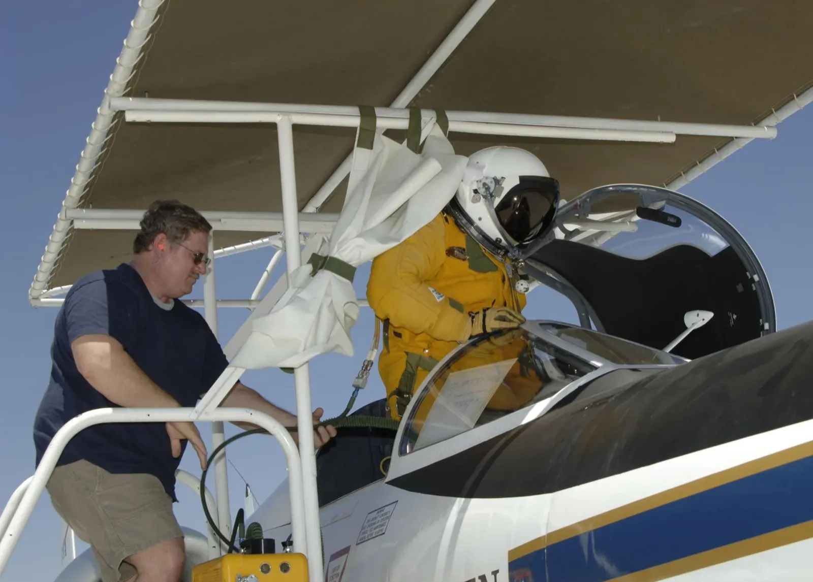
Dressing for 60,000 feet: an ER-2 pilot boards in a full pressure suit. Photo: NASA.
It remains a famously demanding airplane. The pilot wears that suit because above roughly 63,000 feet the air is so thin that, without one, the water in a human body would boil at body temperature. The landing gear is a bicycle: two wheels in a line, with drop-away “pogo” wheels holding the wings level at takeoff, and a chase car sprinting down the runway at landing to call out the last few feet, because from that cockpit the pilot can barely see the ground they’re about to touch.
INSPYRE: flying into the weather that fire builds
What NASA806 is doing this summer is a campaign called INSPYRE, the Injected Smoke and PYRocumulonimbus Experiment, flying out of Great Falls, Montana in the summers of 2026 and 2027, led by the U.S. Naval Research Laboratory with NASA, NOAA, NSF, NCAR, and university partners.
A pyrocumulonimbus, or pyroCb, is what happens when a wildfire burns hot enough to build its own thunderstorm. The fire’s heat drives a column of smoke and moisture upward until it grows a storm cloud of its own, one that can make its own lightning, spark new fires, and punch smoke straight through the weather and into the stratosphere, where it can linger and spread for months. “Pyrocumulonimbus is a unique type of severe weather linked specifically to wildfires,” is how the mission’s lead scientist, NRL’s David Peterson, puts it. The campaign is testing a sharper claim: that as wildfires get bigger and more intense, these fire-built storms will inject more smoke into the stratosphere and measurably change Earth’s radiative balance, which is how much sunlight the planet keeps.
And in late August 2026, the place to study that was exactly where I found the airplane. Washington was having its worst fire year since 2021, with more than 650,000 acres burned. The Little Giant Fire had been running in the Chiwawa River valley since a lightning strike in mid-July: 146,000 acres by late August, a fire that jumped nearly a mile across Lake Chelan, and one that had already built a pyrocumulus tall enough to be seen from Seattle. The Sinlahekin Fire was burning another 155,000 acres to its northeast. I can’t tell you which fire my pair of airplanes was working that afternoon. But a U-2 and a research Gulfstream flying stacked patterns between Puget Sound and the central Cascades, inside INSPYRE’s published flight window, over the biggest smoke sources in the Northwest: I know a mission when I see one. Earlier that month the same ER-2 had been up over British Columbia’s fires, more than a dozen passes in a day, all the way from its base in Montana.
This is genuinely hard weather to study, which is why it takes a small air force. The ER-2 flies above the storm with remote-sensing instruments, including one called iSTORM that watches for gamma-ray flashes from the storm’s lightning, reading the whole cloud from above the way a satellite would. GOES-18, the actual weather satellite, watches from orbit; it caught pyroCbs towering over Utah and Colorado in early July. And down inside the smoke itself flies the airplane I saw underneath my U-2.
The other airplane
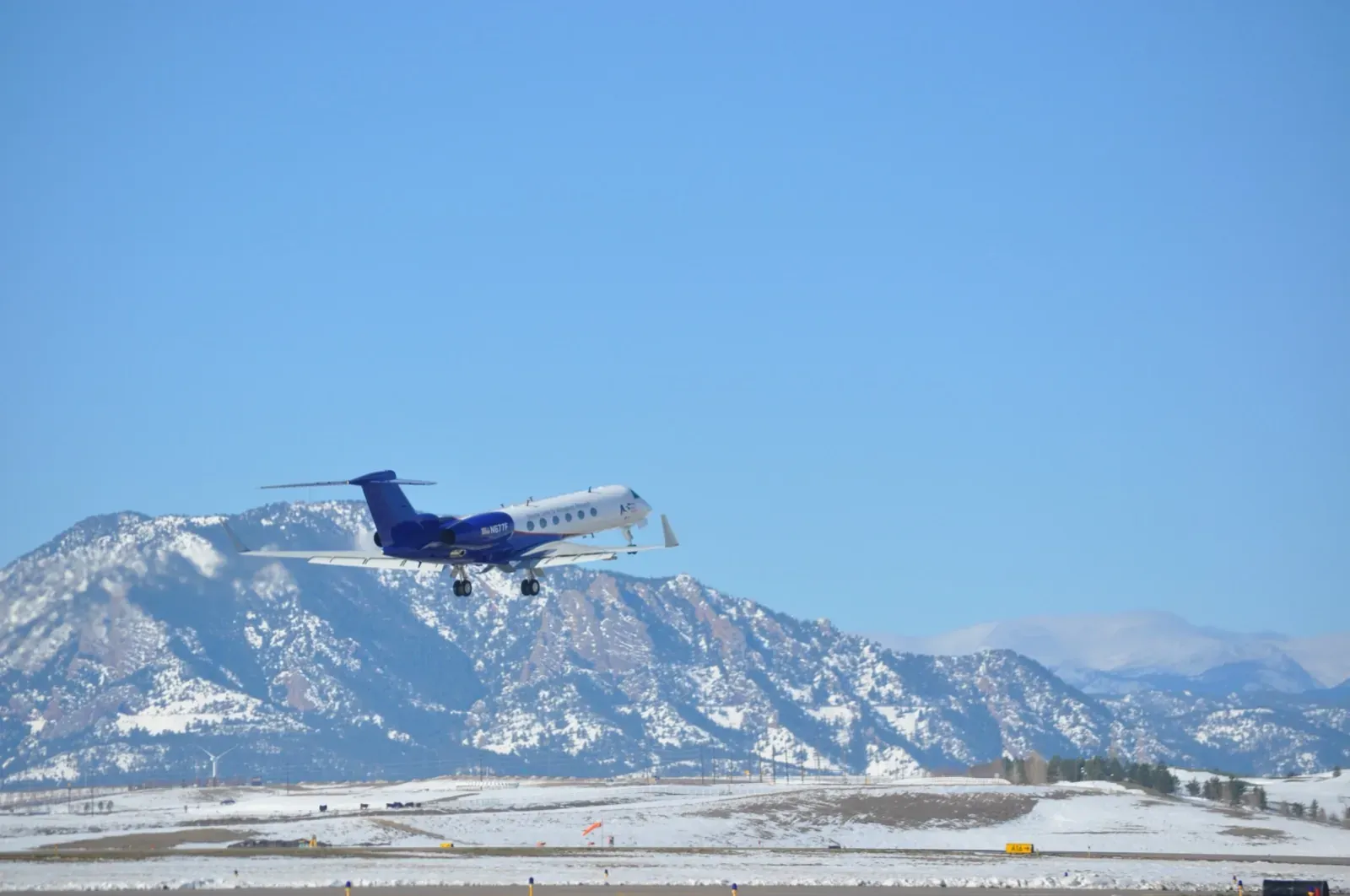
HIAPER, N677F, lifting off from its home field in Broomfield, Colorado, the Flatirons behind it. Photo: NOAA.
N677F is HIAPER, a Gulfstream V owned by the National Science Foundation and operated by the National Center for Atmospheric Research’s Research Aviation Facility out of Broomfield, Colorado. It’s a business jet the way the ER-2 is an airliner, which is to say technically. It can reach 51,000 feet, fly about 7,000 miles, and it carries its instruments into the plume: sampling the smoke, the chemistry, and the turbulence in situ, while the ER-2 reads the same storm from above. Same cloud, measured from inside and outside at once. That is the design of the campaign, and it’s why the two aircraft fly stacked. (It photographs beautifully, too; here’s a proper portrait of it.)
So, was Reddit right?
Closer than most replies on the internet. Satellite calibration and validation is a real and standing part of the ER-2’s job. It has flown storm-intercept campaigns to validate the lightning mapper on GOES-16, and just this spring it was calibrating space sensors against moonlight. And the fire clouds INSPYRE is chasing are exactly the kind of thing weather satellites watch from orbit; airborne measurements like these are how the satellite products stay honest. Right family, wrong campaign. What I watched from that window seat was two airplanes, one high and one low, taking the measure of a storm that a wildfire built.
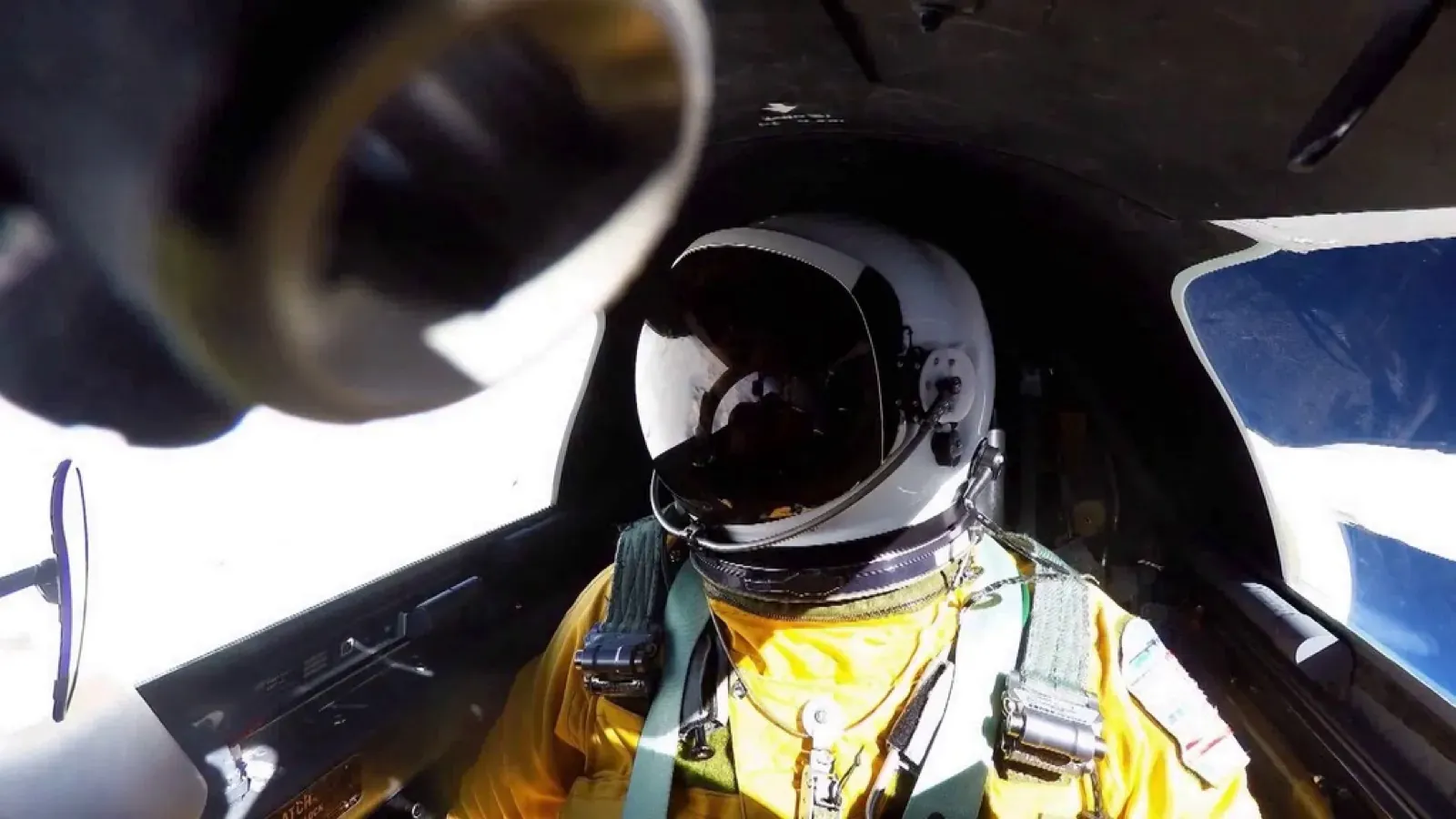
What 65,000 feet looks like from the office: an ER-2 pilot mid-mission during the GOES-16 validation campaign, the weather-satellite work our Reddit commenter remembered. Look at the sky out the right window: that’s where the blue starts running out. Photo: NOAA.
Go find your own
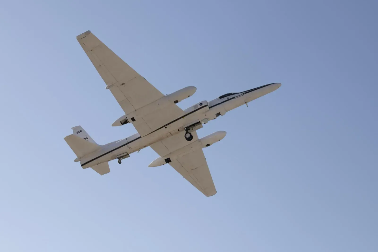
NASA806 itself, from the angle a planespotter gets. Photo: NASA.
This is my favorite kind of planespotting, and you don’t need binoculars for it, just flight tracking with a window seat. The strange callsigns are up there most days: military trainers, fire tankers, research aircraft at impossible altitudes. Open the sky, see what’s really over your house, and when something makes you sit up straight, climb aboard.
NASA806 is scheduled to fly INSPYRE into September. If you’re anywhere in the western U.S., keep an eye out above 55,000 feet.
Sources & further reading: NASA Airborne Science: ER-2 · NASA ESPO: INSPYRE · NRL announcement · CNN on the campaign · The Weather Network on the B.C. flights · NSF NCAR: HIAPER · Little Giant Fire
Photos: NASA / Armstrong Flight Research Center and NOAA (public domain). 3D model: NASA Airborne Science Program.